What Kind of Trees Grow in Lothlórien?

Mallorn Trees

Originally published in Amon Hen, a publication of the Tolkien Society

The forest of Lothlórien, Middle-Earth’s loveliest woodland realm, may well have been inspired by the parks at the University of Oxford, where Tolkien taught for most of his life. Even casual Tolkien scholars know Lothlórien is dominated by mallorn trees, but what can arboriculture tell us about these fictional plants?

Mallorn trees are not indigenous to Middle-Earth. They were brought to Lindon during the Second Age via assisted colonization, where they failed to take root. Later, Galadriel took mallorn seeds east of the Misty Mountains and planted a forest she named Lórinand (“Valley of Gold”) after the leaves of the mallorn, which became Lothlórien in the Third Age [1].

We know from The Lord of the Rings that mallorn trees are tall, gold-leafed, and silver-trunked [2], but Tolkien’s most telling description lies in Unfinished Tales of Númenor and Middle-Earth:

Its bark was silver and smooth, and its boughs somewhat upswept after the manner of the beech…its leaves, like those of the beech but greater, were pale green above and beneath were silver, glistening in the sun; in the autumn they did not fall, but turned to pale gold. In the spring it bore golden blossom in clusters like a cherry, which bloomed on during the summer; and as soon as the flowers opened the leaves fell, so that through spring and summer a grove of malinorni was carpeted and roofed with gold [3].

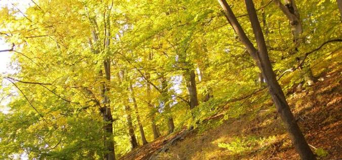
So Lothlórien is essentially an English Lowlands beech forest (pictured above), not unlike Greater London’s Epping Forest or Oxfordshire’s Wychwood. Knowing that the mallorn is an elven form of beech tree does much to clarify the plant’s history, behavior, and significance.

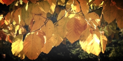
European beech leaves in autumn.

European beech leaves in autumn.

For example, mallorn trees probably failed to take root in Lindon on the western shores of Middle-Earth because of a wet climate. Beeches don’t grow well in water-logged soil, and Lindon lies between the Great Sea and the Blue Mountains, so it’s likely to receive a good deal of rain due to orographic lift, just like the Pacific Northwest of the United States.

And the mallorn‘s seemingly magical ability to keep its leaves through autumn and winter? Actual beech trees do the same thing. It’s called marcescence. Some deciduous trees, including beeches, hold onto their leaves year-round to deter animals from snacking on their twigs.

However, the mallorn trees in Lothlórien–while smaller than their ancestors in Númenor and Tol Eressëa–are quite a bit taller than real-life beeches, especially in Caras Galadhon, the “Fortress of Trees” where Galadriel and Celeborn dwelled. At a height and breadth of 400 feet [4], they’re four to five times taller than the average European beech, and would tower over California’s redwoods (Sequoiadendron giganteum and Sequoia sempervirens, the tallest of which was 379 feet). The leaves, too, were larger than the 2- to 4-inch leaves of beeches (the better to wrap lembas bread, of course).

Finally, the University Parks at Oxford are littered with beech trees, particularly cultivars of European beech (Fagus sylvatica) like Copper beech and Pendulous beech. We know Tolkien had a deep love of nature, and his passion for wood-walking is evident in the work he left behind. Perhaps his Oxford strolls inspired the gold valley of Lothlórien, and the namesake of the Tolkien Society’s annual journal.

1. Tolkien, J. R. R. Unfinished Tales of Númenor and Middle Earth. 168.
2. Tolkien, J. R. R.The Lord of the Rings. 335. 50th Anniversary ed.
3. Ibid. 2, 167.
4. Fonstad, Karen Wynn. The Atlas of Middle-Earth. 130. Rev. ed.
How Tall is Mount Doom?

Mount Doom

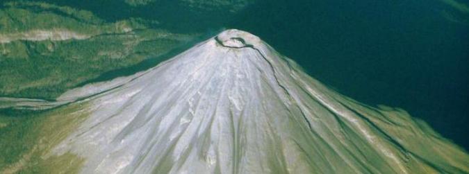
Turns out, the towering volcano where the One Ring was forged…isn’t all that towering, after all. Frodo and Sam’s final hike, while certainly no walk in the park, wasn’t exactly a daring feat of mountaineering prowess, either.

Tolkien was very specific about Mount Doom’s height in The Return of the King:

The confused and tumbled shoulders of its great base rose for maybe three thousand feet above the plain, and above them was reared half as high again its tall central cone [1].

So 3,000 feet for the shoulders, and another 1,500 feet for the cinder cone, equaling 4,500 feet from base to summit. That’s about the same size as Mount Vesuvius, the infamous stratovolcano in Italy that destroyed Pompeii and Herculaneum in 79 AD.

As far as volcanoes go, 4,500 feet is actually quite small. Mount Kilimanjaro, for instance, is over 19,000 feet, and Italy’s other famous volcano, Mount Etna, is nearly 11,000. Even the volcano used as a stand-in for Mount Doom in The Lord of the Rings film series, New Zealand’s Mount Ngauruhoe, is 3,000 feet taller than Tolkien describes.

But elevation isn’t the only reason Frodo and Sam had it easy. Mount Doom’s diameter was 7 miles at the base, meaning the average slope was only 20 degrees [2]. That’s even shallower than Mount Fuji‘s gentle Kawaguchiko trail (21.6 degrees). Most hikers consider anything less that 30 degrees “easy.” You wouldn’t need switchbacks at that angle, making a shorter, direct approach possible.

Not to mention, Frodo and Sam didn’t have to hike all the way to the top. The entrance to Sauron’s Sammath Naur (“Chambers of Fire”) is “high in the upper cone but still far from the reeking summit” [3], which probably puts it near the 4,000-foot mark. And given the diameter and the average slope, they would’ve covered 3.5 miles or so to get there.

So. With an average hiking speed of 2 miles an hour, plus 30 minutes for every 1,000 feet of elevation, the hike from the base of Mount Doom to the door in the cinder cone would take around 4 hours, conservatively. If you’re in good shape and a decent hiker, you could do it even faster.

Of course, Frodo and Sam also had to deal with free-flying chucks of lava and choking clouds of ash. We can glean from Tolkien’s description that Mount Doom, like Vesuvius and Etna, was an active “composite” or “strato-” volcano: a conical mass of layered material from past and present eruptions. A treacherous amalgam of hardened ash, lava, and pumice. Whenever Sauron was at work or gaining strength, Mount Doom was erupting, so the slopes Frodo and Sam climbed would have been constantly changing in size and shape.

Luckily, Frodo and Sam approached Mount Doom from the north. Gaping, steaming fissures had opened up on the southern, western, and eastern slopes of the volcano, and recent lava flows had destroyed the southern slopes of the mountain [4]. But the hobbits reached Mount Doom from the north after escaping from orcs near the Isenmouthe, until they met up with Sauron’s Road (a well-maintained trail that connected Mount Doom to Barad-dûr in the east), which wound its way around the cinder cone, straight to the entrance to the Chambers of Fire.

Thanks to the Great Eagles, the hobbits didn’t even have to make the trek back down the mountain.

I’ve never been so lucky on my own hikes.

1. Tolkien, J. R. R.The Lord of the Rings. 941. 50th Anniversary ed.
2. Fonstad, Karen Wynn. The Atlas of Middle-Earth. 146. Rev. ed.
3. Ibid. 1, 942.
4. Ibid. 2

How Long Does It Take to Walk from the Shire to Mordor?

Originally published in Amon Hen, a publication of the Tolkien Society

Frodo took six months to travel across Middle-Earth, but you could do it in five.

Thanks to Tolkien’s meticulous detail (and the research of scholars like Karen Wynn Fonstad) we know that Frodo covered roughly 1,779 miles [1] on the outbound leg of his journey from the Shire to Mordor.

That’s no walk in the park. It’s the equivalent of walking from Denver to New York City, or from London to Moscow (provided you take the Chunnel, of course). It puts Frodo’s journey roughly equal to the Great Eastern Trail (which runs from Upstate New York to Alabama), but still a few hundred miles short of the Appalachian Trail. In the UK, you’d have to hike the Thames Path nearly 10 times.

We also know that Frodo left Bag End on September 23, and arrived at Mount Doom on March 25 of the following year [2]. That means Frodo’s eastward journey took 183 days [3], which works out to 9.7 miles a day.

Two things. First of all, Frodo cheated [4]. And secondly, you could still do better.

Most hikers can hit an average of 12 miles a day. Beginners may start around 8, and experienced hikers might hit 15 or 20, but  hikers on the Appalachian trail average around 12.7 miles per day [5], covering 2,180 miles in 6 months.

If you, Mr. or Ms. Average Appalachian Trail Hiker, left Hobbitton today and hiked all the way to the top of Mount Doom, it would only take you around 148 days, a full month faster than it took Frodo. And you wouldn’t even have to cheat.

Of course, you wouldn’t be weighed down by the world’s most powerful evil hanging around your neck, either. And you’d probably wear shoes.

1. Fonstad, Karen Wynn. The Atlas of Middle-Earth. Rev. ed.
2. Tolkien, J. R. R. The Lord of the Rings. Appendix C. 50th Anniversary ed.
3. Ibid., Appendix D.
4. Frodo didn’t always travel on foot. On various occasions, he used ponies, wagons, and canoes.
5. “Frequently Asked Questions.” Appalachian Trail Conservancy. Web. 2 May. 2014.